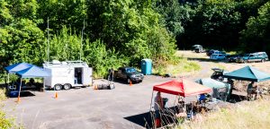
 Again this year MCARES joined the Portland Amateur Radio Club (PARC) on Kelly Butte for ARRL Field Day. Field Day is an annual amateur radio event, encouraging emergency communications operations and contesting among amateur radio operators. It is typically the largest single emergency preparedness exercise in the country, with over 30,000 operators participating each year.
It’s also about outreach and education, letting new hams experience HF contesting, and demonstrating ham radio to the public. But mostly, it’s a fun chance to camp out and play with radios for 24 hours.
Since the new McARES trailer was going to participate again, Deb KK7DEB and John KF7ZWX did some tree pruning near its traditional parking spot early in the week. Then Pete W7PR spearheaded cleaning the operating area and hanging the dipole antenna support ropes in the trees on Friday. As always, Pete’s use of the pneumatic tennis ball launcher system was a big attraction.
Antenna hanging started early Saturday morning. Pete is so experienced with hanging these antennas over the years, his team made short work of it. The station in the trailer used the venerable, 25+ year old extended Zepp 192-foot twinlead-fed dipole again this year, which is cut a little longer than a half wave dipole on 75m to increase its directionality. Lee’s CW station used his 20m ZL Special, which is a pair of phased folded dipoles made of 450ohm twinlead set up with directional gain pointing east. In the evenings it’s reconfigured with radials as a top loaded vertical to operate on 80m and 40m. Pete also hoisted an Alpha Delta DC-CC, which is a commercial 10-80m 82-foot dipole, up about 75 feet.
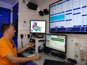 Deb arrived early with the trailer and had it set up in no time. Its propane fueled generator powered everything in the camp, except the radios, for 24 hours without a hitch – including battery recharging duty.
The trailer also furnished area WiFi for all the logging stations used by the radio operators. PARC has been using the Field Day edition of a contesting software package called Amateur Contest Log for years, and it has excellent multi-operator network capabilities. Unfortunately, the trailer’s WiFi couldn’t reach even one station, so Brian KE7QPV configured one of his mesh nodes as a repeater. You could get a signal in Salem with his outdoor, high-gain antenna.
Brian also brought his amazing HSMM Mesh display and did a bunch of experimenting over the evening with all his different hardware configurations. Deb brought the new MCARES solar generator display which was very popular and a big draw with the visitors. Nathan N9VCU grilled up a storm during the day and the evening potluck was delicious!
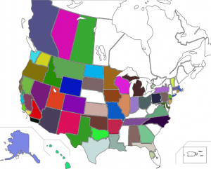 With three stations operating over 24 hours, over 300 contacts were made covering 45 states by 21 operators. See the adjacent screenshot of the cool worked-states map.
Over 70 visitors came by and signed the log, a jump from last year. Amazingly, Adam KF7LJH wasn’t told mysterious secrets by a coyote in his tent this year (the story gets exaggerated with each telling).
If you couldn’t make it this year, definitely put it on your calendar for next year – it’s the most fun you’ll have with ham radio short of a DX expedition!
Tagged as:
Field Day
 Our group is taking over the majority of Loop G At Fort Stevens State Park for this event, and there are quite a few spaces still available on this loop if you would like to join us. The spots are $29 per night, and you’re welcome to join us for both nights or just one.These spots will all accommodate an RV and have electrical hookups. So far, spots G-264 through G-269 have been reserved by our members if you would like to camp near us. There are about a dozen spaces remaining on this loop, so we would encourage you to reserve quickly if you are planning to join us.
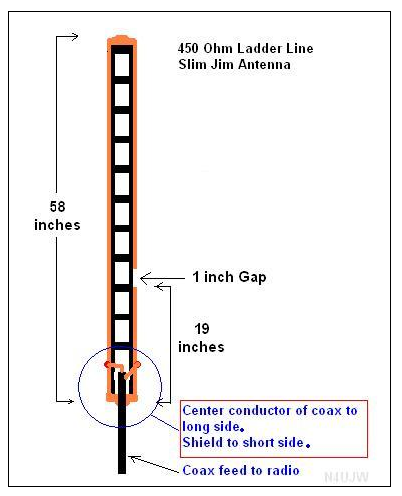 We’re going to try to keep the momentum going this month with a discussion and live build demonstration of a Slim Jim portable antenna. Click


 The July meeting will be our annual Go-Kit Show and Tell, and we encourage everyone to bring their field operating gear and ideas to demonstrate and discuss. We’re stepping things up a bit this year, showing off the Multnomah County